Company
TERRASIGNA
Every day, zettabytes of data are acquired from satellites and other geographic information systems. From this, we select the data relevant for specific applications, we analyse and process it, and turn it into usable information, by using in-house created and developed algorithms and techniques.


About
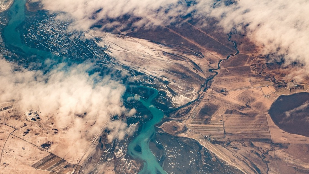
TERRASIGNA. Romanian company having main expertise in processing, analysis and interpretation of optical and radar Earth Observation data, offers innovative solutions for environmental monitoring and risk assessment (flood risk analysis, drought early warning, deforestation evaluation etc.).
Floods; Forests; Marine ecosystem; Metocean; Forestry; Oil and Gas
Certifcation
Website
Registration Number
3522
Address
3 Logofat Luca Stroici Street 020581 Bucharest
Telephone
+40 21 313 33 14
Fax
+40 21 313 33 14
Contact Name
COSTEA, ANCA
Contact Position
—
Contact Telephone
Phone: +40 21 313 33 14 Fax: +40 21 313 33 15
Contact Email
anca.costea@terrasigna.com
Value chain
HQ location
3 Logofat Luca Stroici Street, 020581
Services comparison
services
Related Content
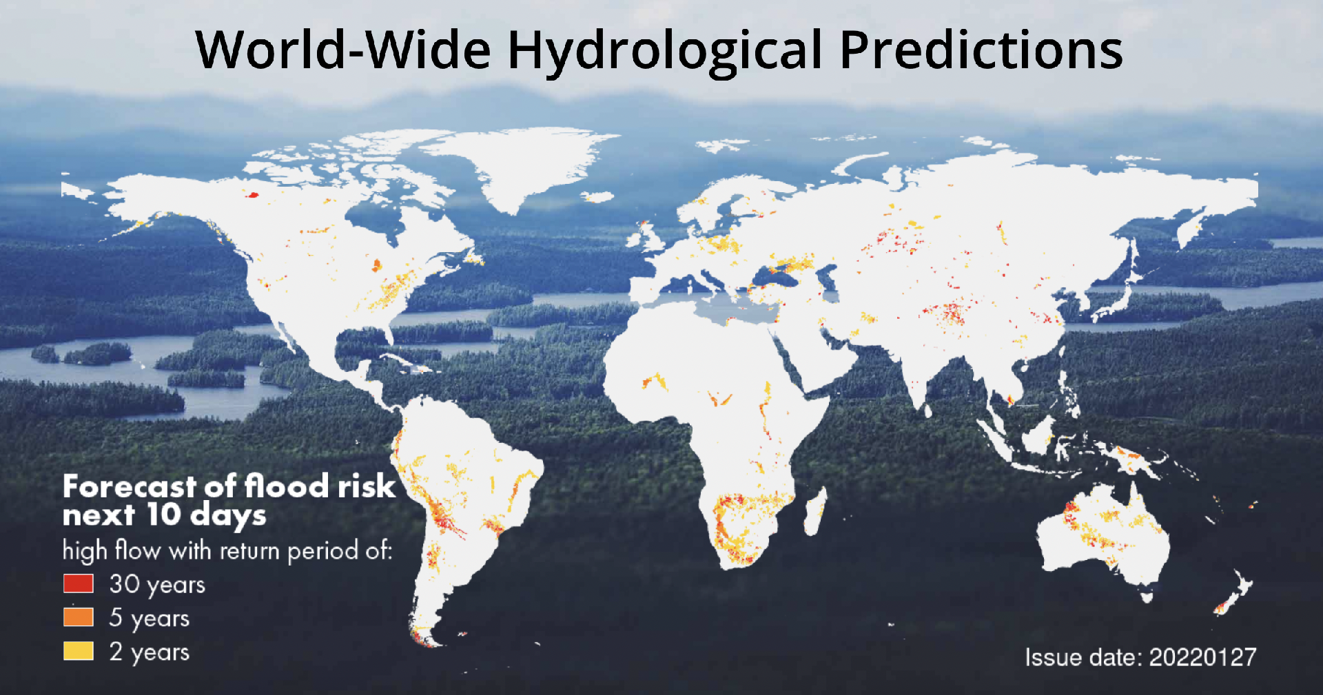
Earth Science Data Access and PrOcessing Service for Black Sea (ESPOSS)
Coastal, Marine ecosystem, algal bloom, ocean colour compositte, sea surface temperature, turbidity, chlorophyll-a concentration, Maritime, Local and regional planners
EPSOSS takes advantage of the high investments made by the European countries and their international partners in ES data collection and dissemination systems (e.g. satellites, in-situ networks, ICT frameworks) and builds on top of those systems an added value application (geoportal) for the scientific community and the Black Sea relevant decision makers on environmental issues. ESPOSS offers: - Friendly interface - easy to use graphical user interface and intuitive workflows. - 10 000+ satellite derived data layers - the product portfolio includes: Sea surface temperature, chlorophyll concentration, diffuse attenuation coefficient, total suspended matter, etc. - Modern architecture - ESPOSS architecture design is driven by service-oriented architecture design principles, and use open standards from IETF, W3C, OASIS, ISO/TC 211, and OGC. - Open source based - ESPOSS GeoPortal is built completely with free and open source software. - Modular and scalable - the geoportal is based on a modular and scalable software architecture that enables an efficient deployment, control, and management of active services. - Network services - implements Open Geospatial Consortium (OGC) standards for data retrieval (WMS, WCS, WFS) and server-side processing (WPS). - Active community - fast growing international user community. - Powerful visualizations - effective data visualization methods, suitable for analysis of big volumes of multi-temporal data. - Server-side processing services - currently the service has interfaces for the following types of geospatial processing functions: buffer, clip, resample, profile and raster algebra.
Added
Added
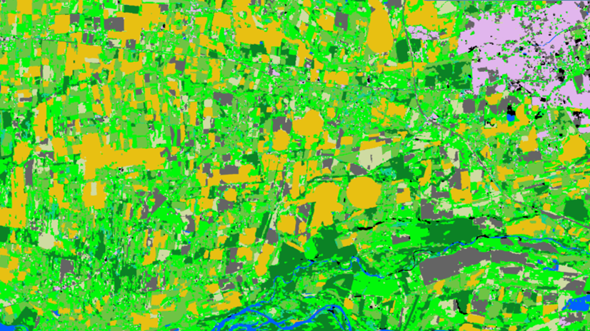
Land Cover Analysis 
Floods, Inland Water, Land Ecosystems, Geology, Forests, Infrastructure, Land use, Urban Areas, Fires, Earthquakes, Construction, Emergency Services, Environmental, Pollution & Climate, Farming, Utilities (water, electricity, waste) , Oil and Gas, Minerals and Mining
LCA stands for Land Cover Analysis and is used to provide an up to date, digital overview of what covers the surface of our earth split out into 10 key land cover classes. The LCA is often the first step in many environmental monitoring or site selection processes.
Added
Added

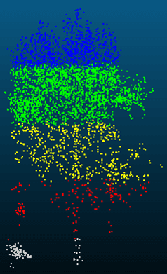
5D Multi-Purpose LIS (Land information System) 
Agriculture, Infrastructure, Coastal, Floods, Forests, Inland Water, Land Ecosystems, Land use, Landslides, Sea-ice and icebergs, Snow & Ice, Topography, Urban Areas, Security, Assess Environmental impact of farming, Monitor crops, Assess Deforestation / Forest Degradation, Assess environmental impact of forestry, Assess and monitor water bodies , Monitor land ecosystems and biodiversity, Monitor land cover and detect change , Baseline mapping , Map line of sight visibility (land surface), Asset infrastructure monitoring, Monitor coastal ecosystem, Monitor the coast line, Map and assess flooding, Detect and monitor wildfires, Forecast and assess landslides, Monitor sensitive risk areas, Forecasting epidemics and diseases, land administration, land use studies, monitoring of settlements, urban atlas, urban development, smart cities, rural areas, building inventory, building footprint, spatial planning, land cover, Solar energy, Construction, Forestry, Real-estate management, Transportation
The complexity of modern urban environments has led to the introduction of 3D Land Information Systems (LISs), which tend to replace traditional 2D LIS architectures for the purposes of urban planning and regeneration, land administration, real estate management and civil development. Both the need for 3D visualization of the geometry of buildings in various time instances through the years and the need for acquisition of 3D models in various levels of detail (LoDs), which not only fulfill the requirements of the various users but also they speed up the visualization process, are obvious. Thus, additional dimensions, that is, for time and scale, need to be supported by a modern LIS. This service introduces a 5D modelling pipeline that may be adopted by a multi-purpose LIS for the selective creation of 3D models of an urban area in various time instances and at various LoDs, enriched with cadastral and other spatial data. The methodology is based on automatic change detection algorithms for spatial-temporal analysis of the spatial changes that took place in subsequent time periods, using image orientation, dense image matching and structure from motion algorithms, the procedure requires photogrammetric stereo plotting, implements procedural modelling and relies on the availability of overlapping aerial and terrestrial imagery, ground control points and cadastral information.
Added
Added
Monitoring trees 
Forests, Assess Deforestation / Forest Degradation, Assess forest damage due to storms or insects, Monitor forest resources, Land use, Forestry, Forest policy, Forest policy makers, Logging industry, Wood industry
NEO is monitoring trees using satellite data and deep learning methodologies. This service informs people about the status of different trees species in their surrounding/municipality. Trees managed by municipalities can be checked on presence and correct attributes such as tree height.
Added
Added