angle-left null Firemaps.net
Mapping, Feature extraction, Monitoring

Firemaps.net

Firemaps.net provides monitoring of fires from satellites.

Fires; burnt scars; damage; forest fire risk; fire extent; Climate

Product Description

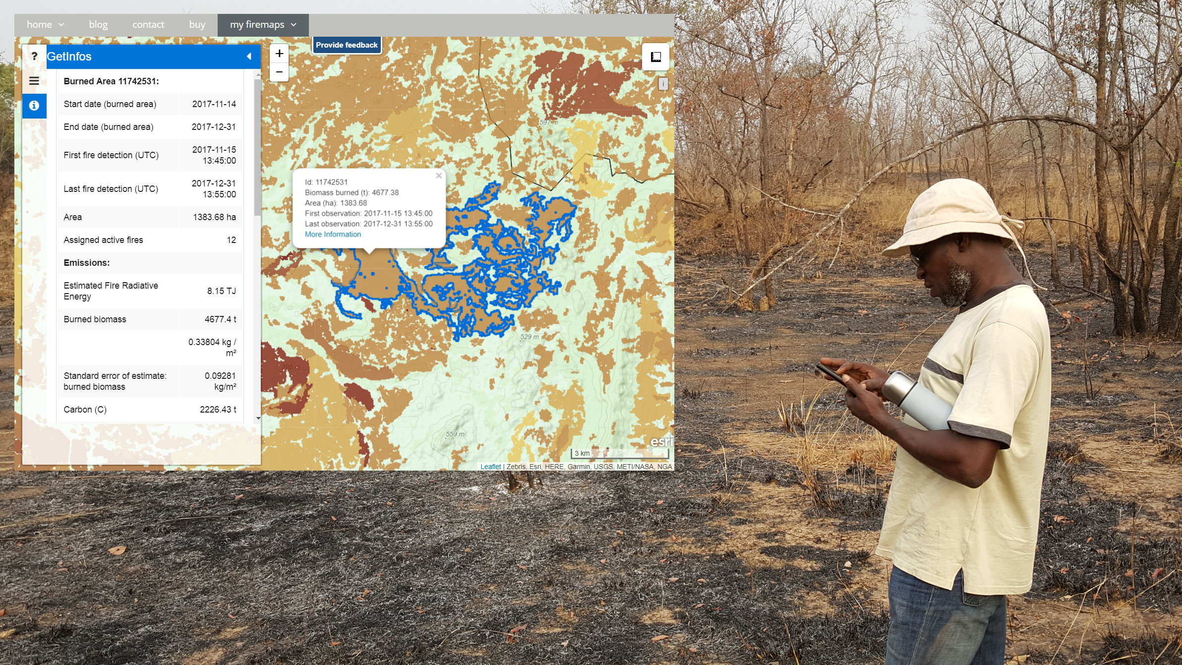
Firemaps.net provides monitoring of fires from satellites. We use mostly free Earth observation data form the Sentinel fleet and from NASA and Eumetsat, as well as weather and climate data from different providers. All data are automatically downloaded and processed in a cloud environment and delivered to the user through our firemaps.net platform. firemaps.net offers a web mapping and information interface, provides the products for download in the desired format and features a reporting ready fire statistics on user defined areas of interest. Using NASA MODIS and Landsat data we provide time series of over ten years for fire baseline assessment. Coupling Earth observation and weather data we provide online modelling of fire behaviour and fire risk. We currently develop a mobile app for offline use of firemaps.net.

Service Language
English, Dutch
Metadata Language
English
Service Level Agreement
SLA's upon request
Terms & Conditions
Licence
Delivery Mode
  • download, webGIS
Commercial level
Commercial
Service Life Cycle Status
Production
Scale
1:50000 to 1:500000
Service Locator
Date of Publication
01 Jul 2019

Benefits

Monitoring of burned area, planning of fire management, monitoring of fire emissions

  • Easy to use interface with no data processing skills required
  • Ready to use statistics and charts
  • Weekly updates of burned area
  • Establishment of management objectives and the ability to track and report success
Payment Model
Subscription
Price starting from
0.5 €/sqkm

Technical Specification

Deliverable spatial resolution
20.0 - 500.0 m
Deliverable accuracy vertical
Deliverable accuracy horizontal
20m-500m
Deliverable raster layers
  • monthly to daily fire risk, potential fire intensity at time of burning, fire return interval, modelled fire intensity, modelled fire rate of spread
Deliverable vector layers
  • burned area, fire emissions
Deliverable Accuracy
Accurracy of GHG emission estimates is available with the product. Annual emisison estimates accuracy is variable and depends of a number of factors. Burned area accuracy assessment as an additional service. Fire intensity accuracy assessment under development
Formats
  • OGC WMS, WCS, GeoTiff, shapefile, kml, others upon request
Deliverable datamodel
Datamodel available upon request
Deliverable datum
WGS 84 Lat/lon or UTM, others upon request
Datum translator
Start date of acquisition
End date of acquisition
Status
Bespoke

Service place

Global (with a focus on Africa, South America and South East Asia)

48.136727199999996,11.56298312546921