Galerie
Gallery
Mapping, Feature extraction, Monitoring
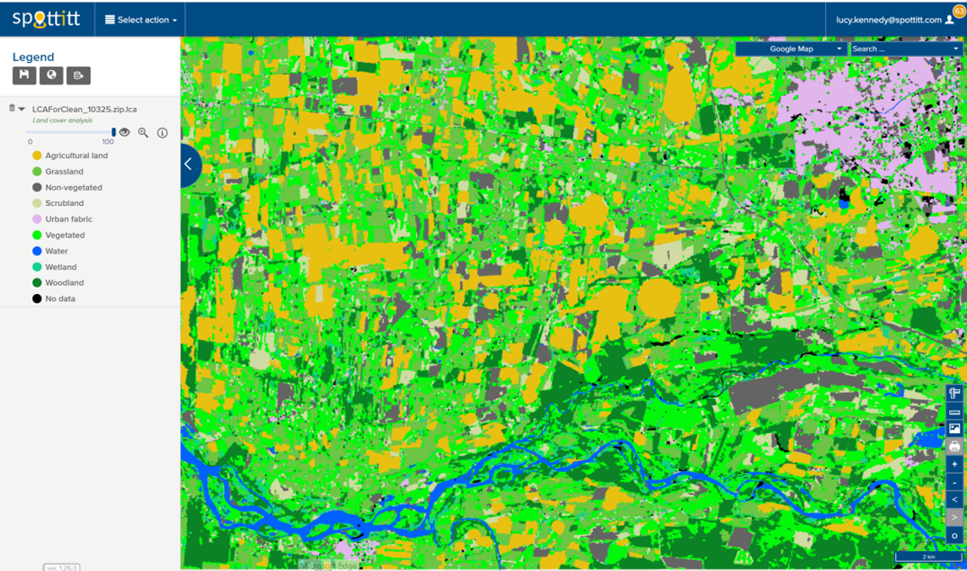
Land Cover Analysis
10m resolution digital land cover anlaysis with 13 different land cover classes. Derived automatically from free Sentinel 2 imagery which provides global coverage and a 5 day refresh cycle.
Floods; Inland Water; Land Ecosystems; Geology; Forests; Infrastructure

Description du produit
LCA stands for Land Cover Analysis and is used to provide an up to date, digital overview of what covers the surface of our earth split out into 10 key land cover classes. The LCA is often the first step in many environmental monitoring or site selection processes.
Avantages
Land cover analysis based on recent satellite imagery – a date stamped image doesn’t lie. Automated land cover anaysis ready in only 4-8 hours. Cost effective, exact pricing depends on subscription chosen. Spottitt geoportal provides all the benefits of cloud based storage and sharing – no more WeTransfer
Spécifications techniques
Lieu de service
Global

