angle-left null Monitoring trees
Monitoring

Monitoring trees

NEO is monitoring trees using satellite data and deep learning methodologies. Basic information such as height, diameter and species of trees can be monitored with our service.

Forests; Assess Deforestation / Forest Degradation; Assess forest damage due to storms or insects; Monitor forest resources; Land use; Forestry
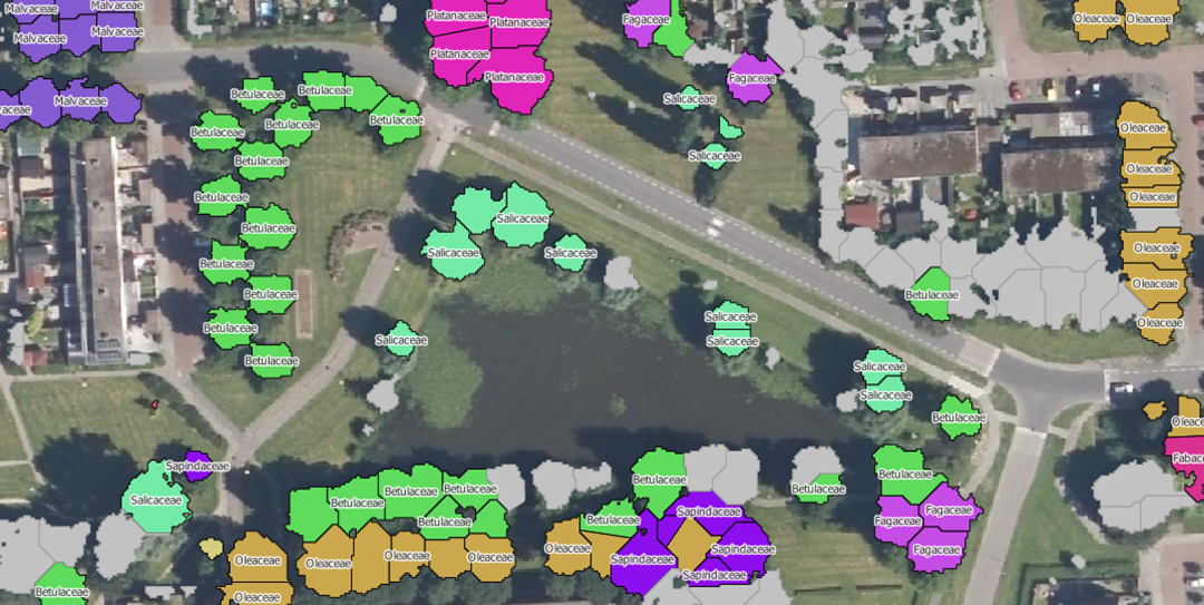
Family, species, and genus of trees

Description du produit

NEO is monitoring trees using satellite data and deep learning methodologies. This service informs people about the status of different trees species in their surrounding/municipality. Trees managed by municipalities can be checked on presence and correct attributes such as tree height.

Langue de service
English, Dutch
Langue des métadonnées
English, Dutch
Contrat de niveau de service
Commercial
termes et conditions
Licence
Mode de livraison
  • Spatial data and report
Niveau commercial
Commercial
Statut du cycle de vie du service
Production
Échelle
Several provinces in the Netherlands
Localisateur de service
Date de publication
24 déc. 2019

Avantages

Benefits description

  • Satellite images cover a large area in a short time.
  • Low prices compared to field research
  • Forest inspectors know exactly where to look
Modèle de paiement
Prix à partir de

Spécifications techniques

Résolution spatiale livrable
0.5 m
Précision livrable verticale
1.5 m
Précision livrable horizontale
1.5 m
Couches raster livrables
  • Satellite mosaic
Couches vectorielles livrables
  • Change detection signals
Précision livrable
95%
Les formats
  • .ECW, .shp
Modèle de données livrable
Flexible
Données livrables
Flexible
Traducteur de données
Flexible
Date de début de l'acquisition
2016-01-01
Date de fin de l'acquisition
Statut
Automatic Processing

Lieu de service

Netherlands

52.1532978,5.3806592