angle-left null Firemaps.net
Mapping, Feature extraction, Monitoring

Firemaps.net

Firemaps.net provides monitoring of fires from satellites.

Fires; burnt scars; damage; forest fire risk; fire extent; Climate

Descrizione del prodotto

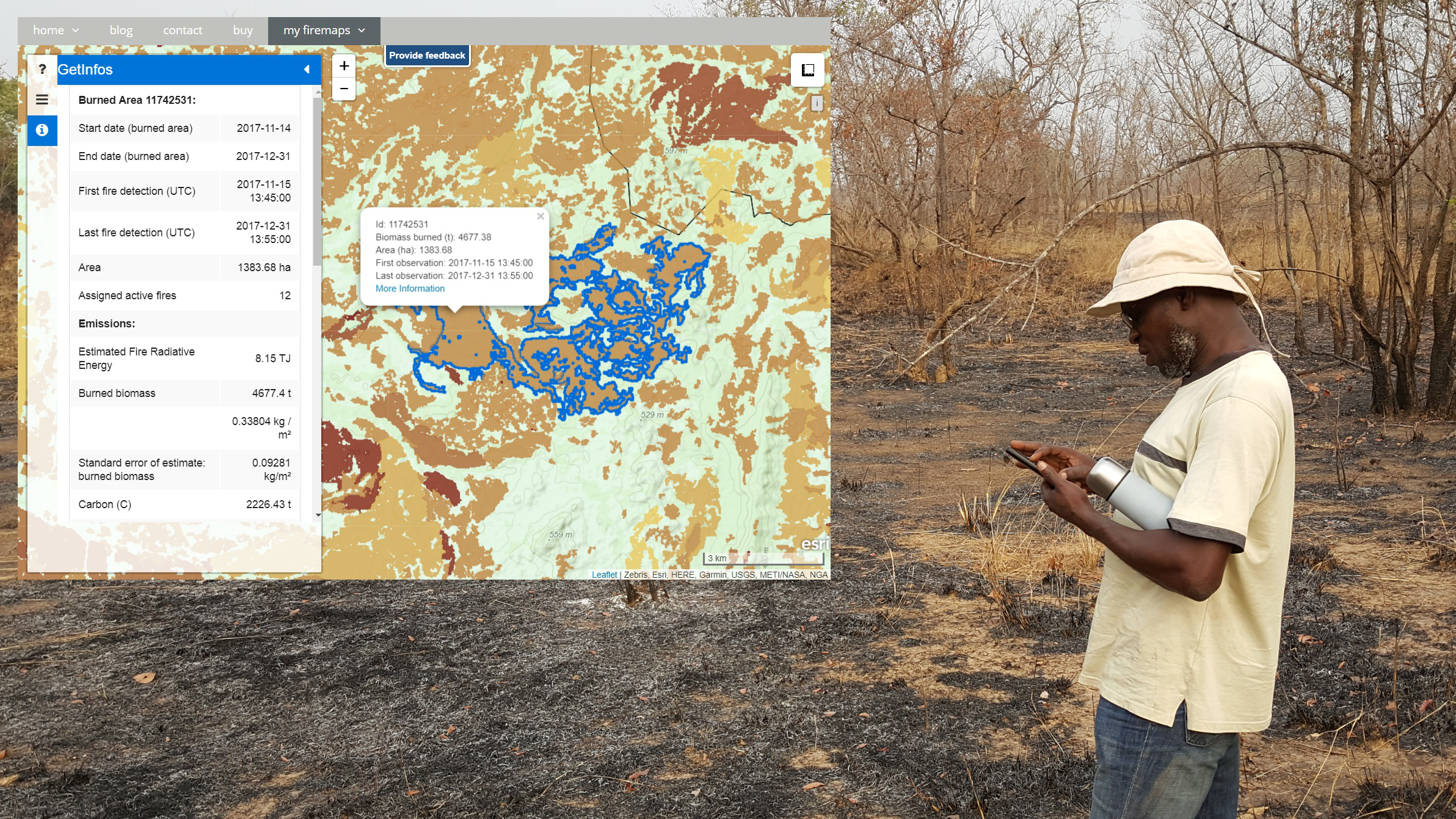
Firemaps.net provides monitoring of fires from satellites. We use mostly free Earth observation data form the Sentinel fleet and from NASA and Eumetsat, as well as weather and climate data from different providers. All data are automatically downloaded and processed in a cloud environment and delivered to the user through our firemaps.net platform. firemaps.net offers a web mapping and information interface, provides the products for download in the desired format and features a reporting ready fire statistics on user defined areas of interest. Using NASA MODIS and Landsat data we provide time series of over ten years for fire baseline assessment. Coupling Earth observation and weather data we provide online modelling of fire behaviour and fire risk. We currently develop a mobile app for offline use of firemaps.net.

Lingua di servizio
English, Dutch
Lingua dei metadati
English
Accordo sul livello di servizio
SLA's upon request
Termini & Condizioni
Licenza
Modalità di consegna
  • download, webGIS
Livello commerciale
Commercial
Stato del ciclo di vita del servizio
Production
Scala
1:50000 to 1:500000
Localizzatore di servizi
Data di pubblicazione
01 lug 2019

Benefici

Monitoring of burned area, planning of fire management, monitoring of fire emissions

  • Easy to use interface with no data processing skills required
  • Ready to use statistics and charts
  • Weekly updates of burned area
  • Establishment of management objectives and the ability to track and report success
Modello di pagamento
Subscription
Prezzo a partire da
0.5 €/sqkm

Specifica tecnica

Risoluzione spaziale consegnabile
20.0 - 500.0 m
Precisione consegnabile verticale
Precisione consegnabile orizzontale
20m-500m
Livelli raster consegnabili
  • monthly to daily fire risk, potential fire intensity at time of burning, fire return interval, modelled fire intensity, modelled fire rate of spread
Livelli vettoriali consegnabili
  • burned area, fire emissions
Precisione consegnabile
Accurracy of GHG emission estimates is available with the product. Annual emisison estimates accuracy is variable and depends of a number of factors. Burned area accuracy assessment as an additional service. Fire intensity accuracy assessment under development
formati
  • OGC WMS, WCS, GeoTiff, shapefile, kml, others upon request
Datamodel consegnabile
Datamodel available upon request
Dato consegnabile
WGS 84 Lat/lon or UTM, others upon request
Traduttore di riferimento
Data di inizio dell'acquisizione
Data di fine dell'acquisizione
Stato
Bespoke

Luogo di servizio

Global (with a focus on Africa, South America and South East Asia)

48.136727199999996,11.56298312546921