WindSight

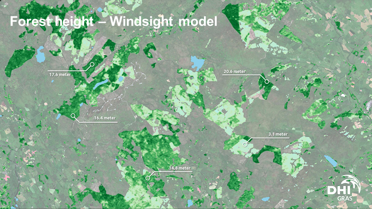
WindSight is a suite of novel EO-based products for characterization of the land surface roughness and topography anywhere in the world. Together with state-of-the-art flow modeling tools for wind energy planning and prospecting, WindSight can replace current procedures for land surface characterization, which are based on manual assessment, coarse global data sets, or costly airborne measurement campaigns.
Product Description

Mapping the requirements and the willingness to pay for data at different stages of land based wind farm planning. Establish co-creation cycles with end users from the wind energy industry. Develop a sustainable business case for the provisioning of EO data and derived products over land to the wind energy industry.

Service Language
Metadata Language
Service Level Agreement
Terms & Conditions
Licence
Delivery Mode
Commercial level
Commercial
Service Life Cycle Status
Scale
Service Locator
Date of Publication
20 Jul 2022

Benefits

Benefits description

Payment Model
Price starting from

Technical Specification

Deliverable spatial resolution
Deliverable accuracy vertical
Deliverable accuracy horizontal
Deliverable raster layers
Deliverable vector layers
Deliverable Accuracy
Formats
Deliverable datamodel
Deliverable datum
Datum translator
Start date of acquisition
End date of acquisition
Status

Service place

Service place description

52.23867161657315,21.066563768529967

Compare products

0 products added

Compare

Services comparison

services

Related Content

Satellite-derived Bathymetry
Coastal, Fisheries, Map water depth or charting, Oil and Gas, Maritime
A cost-effective method for accurate water depth mapping of the worlds shallow coastal areas based on high resolution satellite images. The method is globally applicable.
Added
Added
EO based phytoplankton biomass service
Inland Water, Assess and monitor water bodies   , Local and regional planners, Regional governments, City authorities, Environment, Utilities (water, electricity, waste) , Water plants, Coastal management agencies
Using knowledge about how certain substances, such as one of the main pigments of the phytoplankton (Chlorophyll a - Chl a) alter the colour of the water, these parameters can be derived from optial Earth Observation (EO) satellite sensors. Water Insight provides monitoring services of Chl a based on EO data which is validated with in situmeasurements. Also the maps of WFD phytoplankton biomass status classes are created, by application of the WFD tresholds on Chl a as a proxy for phytoplankton biomass. The maps are made available in a portal, which allows to follow the lakes in time, zoom and download maps and time series.
Added
Added