Historia exitosa
How Satellite Earth Observation Can Help With Monitoring For The Water Framework Directive


Perfil
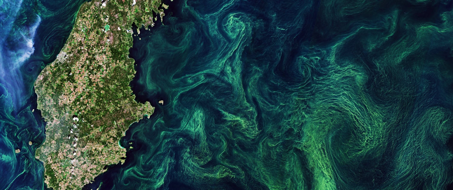
Using knowledge about how certain substances, such as one of the main pigments of the phytoplankton (Chlorophyll a - Chl a) alter the colour of the water, these parameters can be derived from optial Earth Observation (EO) satellite sensors.

Propuesta
Water Insight provides monitoring services of Chl a based on EO data which is validated with in situmeasurements. Also the maps of WFD phytoplankton biomass status classes are created, by application of the WFD tresholds on Chl a as a proxy for phytoplankton biomass. The maps are made available in a portal, which allows to follow the lakes in time, zoom and download maps and time series.

Beneficios
- cheap and automated monitoring for under-sampled lakes, combined with targeted sampling in case of unexpected changes
- systems analysis, for which the spatial component is key
- evaluation of the spatial effect of measures taken to improve water quality for the WFD as input for spatial ecological models

Comparación de servicios
servicios
contenido relacionado
EO based phytoplankton biomass service
Inland Water, Assess and monitor water bodies , Local and regional planners, Regional governments, City authorities, Environment, Utilities (water, electricity, waste) , Water plants, Coastal management agencies
Using knowledge about how certain substances, such as one of the main pigments of the phytoplankton (Chlorophyll a - Chl a) alter the colour of the water, these parameters can be derived from optial Earth Observation (EO) satellite sensors. Water Insight provides monitoring services of Chl a based on EO data which is validated with in situmeasurements. Also the maps of WFD phytoplankton biomass status classes are created, by application of the WFD tresholds on Chl a as a proxy for phytoplankton biomass. The maps are made available in a portal, which allows to follow the lakes in time, zoom and download maps and time series.
Adicional
Adicional
Farmstar ![Airbus defence and space]()
Agriculture
Discover Farmstar's holistic precision agriculture solutions, seamlessly integrating satellite imagery, advanced sensors, and data analytics. Our products not only optimize crop management but also prioritize carbon-conscious farming. From monitoring carbon sequestration in soils to recommending eco-friendly practices, Farmstar leads the way in sustainable agriculture, helping more than 13 000 farmers yearly to cultivate responsibly and efficiently.
Adicional
Adicional