Remote sensing / GIS
Snow Monitoring
With COSMOS (Continous Snow Monitoring System) we provide near-realtime global snow cover maps in different spatial resolutions.
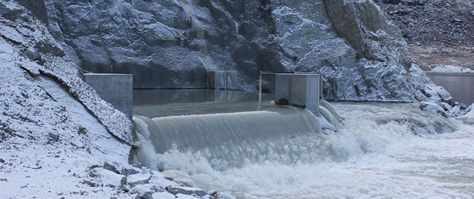
climate change; Assess ground water and run-off; Monitor snow cover; snow cover; Environment; Hydroelectric

Opis produktu
Continous Snow Monitoring System is available as global 500 m resolution snow cover, regional 20 m resolution snow cover for various areas and 20 m resolution snow depth product for Switzerland, the Rocky Mountains and Sierra Nevada. All algorithms can be further extended to any regions of interest.
Język usługi
English
Język metadanych
English
Umowa o poziomie usług
Commercial
Zasady i Warunki
Licencja
Sposób dostawy
Poziom komercyjny
Commercial
Status cyklu życia usługi
Production
Skala
Global
Lokalizator usług
Data publikacji
01 lut 2020
Korzyści
Benefits
- Easy Access
- Daily updated
- Globally applicable
- Integrates of previous observations
Model płatności
Subscription
Cena od
—
Miejsce obsługi
Service place description
Worldwide
47.36303305,8.563719142261906
Porównanie usług
usługi
powiązana zawartość
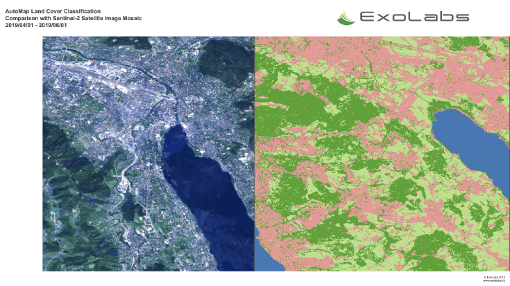
Land and Land Cover Analysis 
Agriculture, Infrastructure, Land Ecosystems, Land use, Farming, Insurance & Finance, Local and regional planners
With AutoMap, the handling of satellite images has never been easier! We simplify the production of maps based on earth observation data and handle the application of machine learning algorithms for land surface classifications by providing a solid data processing pipeline in a fully managed cloud infrastructure. Bring your own samples or use our default solution, while we take care of the thousands of images that fit your request, all the clouds in your area of interest and every aspect of process optimization and secure data storage. Don't worry about machine learning concepts, intelligent training data collection, hyperparameter optimization or informative feature spaces - That's our job as well! Seeing the world from above is now as demanding as ordering a pizza!
Dodany
Dodany
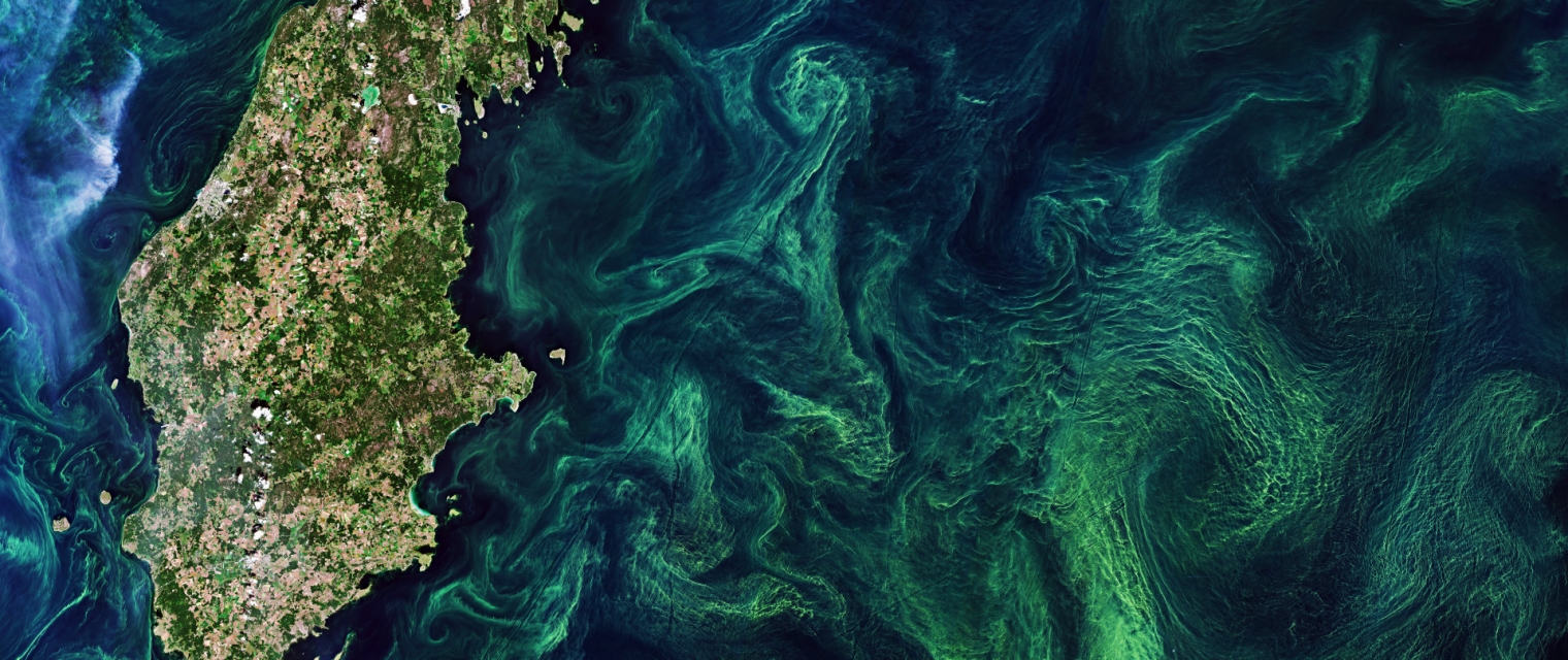
EO based phytoplankton biomass service 
Inland Water, Assess and monitor water bodies , Local and regional planners, Regional governments, City authorities, Environment, Utilities (water, electricity, waste) , Water plants, Coastal management agencies
Using knowledge about how certain substances, such as one of the main pigments of the phytoplankton (Chlorophyll a - Chl a) alter the colour of the water, these parameters can be derived from optial Earth Observation (EO) satellite sensors. Water Insight provides monitoring services of Chl a based on EO data which is validated with in situmeasurements. Also the maps of WFD phytoplankton biomass status classes are created, by application of the WFD tresholds on Chl a as a proxy for phytoplankton biomass. The maps are made available in a portal, which allows to follow the lakes in time, zoom and download maps and time series.
Dodany
Dodany
Sargassum Monitoring- SAMTool service 
Environmental, Pollution & Climate, Environment, Regional governments, Local and regional planners, Travel, Tourism and Leisure
Detection and sargassum influxes identification at their earliest stage using a synergy of satellite sensors, combined with drift modelling
Dodany
Dodany
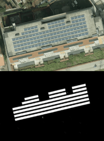
Solar panel service 
Infrastructure, Map and monitor solar energy (solar farms), solar energy, solar radiation, Monitor urban areas, Urban Areas, urban development, urban settlement, urban atlas, urban areas, smart cities, individual houses inventory, Alternative Energy, Regional planners, Solar energy, Environment, Real-estate management
NEO monitors solar panels throughout the Netherlands using deep learning methods. Solar panels are detected using various resolutions of satellite and aerial imagery. The panels are digitalized by the algorithm and related to 3D-roofs based on the AHN (Dutch national height model) to calculate zenith and azimuth angles. This data, combined with data such as solar power, allows NEO to estimate the power output for each object. Solar panels are also provided with parcel and address information and statistical reports, so customers can easily apply the data and relate it to internal registrations.
Dodany
Dodany