Mapping, Monitoring
Sargassum Monitoring- SAMTool service
Detection and sargassum influxes identification at their earliest stage using a synergy of satellite sensors, combined with drift modelling
Environmental, Pollution & Climate; Environment; Regional governments; Local and regional planners; Travel, Tourism and Leisure


Descripción del producto
Detection and sargassum influxes identification at their earliest stage using a synergy of satellite sensors, combined with drift modelling
Idioma de servicio
FR, EN, SP
Lenguaje de metadatos
FR, EN, SP
Acuerdo de nivel de servicio
Daily update of the satellite images and drift prediction
Términos y condiciones
Licencia
Modo de entrega
Nivel comercial
Commercial
Estado del ciclo de vida del servicio
Production
Escala
Regional and local
Localizador de servicios
Fecha de publicación
22 ago 2022
Beneficios
Benefits description
- Access to up to date information on Sargassum position , overall situation and immediate landings
Modelo de pago
Subscription
Precio a partir de
—
Especificación técnica
Resolución espacial entregable
20.0 - 300.0 m
Precisión de entrega vertical
—
Precisión de entrega horizontal.
—
Capas raster entregables
Capas vectoriales entregables
Precisión de entrega
—
Los formatos
Modelo de datos de entrega
—
Datos de entrega
—
Traductor de datos
—
Fecha de inicio de adquisición
—
Fecha de finalización de la adquisición
—
Estado
On the shelf
Lugar de servicio
Caribbean Islands and Sea, Tropical Atlantic, West Africa, Gulf of Mexico
Caribbean Sea
16.2490067,-61.5650444
Comparación de servicios
servicios
contenido relacionado
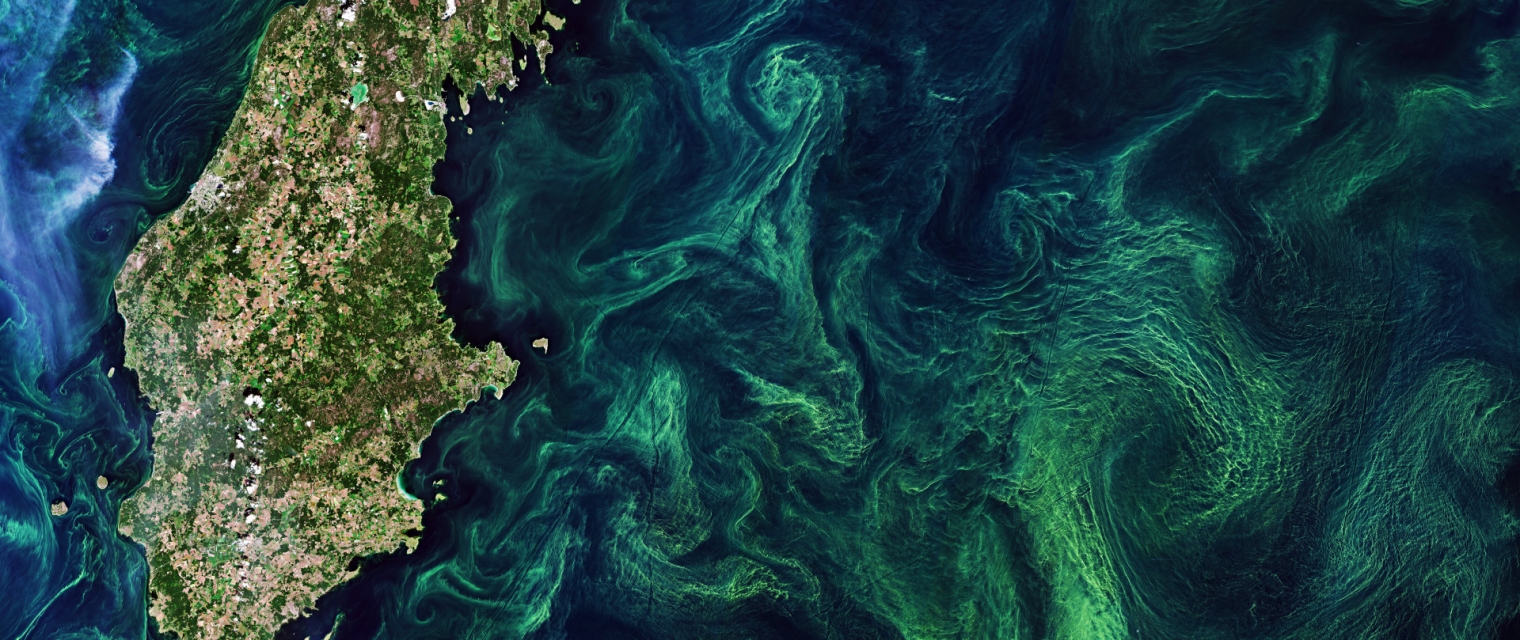
EO based phytoplankton biomass service 
Inland Water, Assess and monitor water bodies , Local and regional planners, Regional governments, City authorities, Environment, Utilities (water, electricity, waste) , Water plants, Coastal management agencies
Using knowledge about how certain substances, such as one of the main pigments of the phytoplankton (Chlorophyll a - Chl a) alter the colour of the water, these parameters can be derived from optial Earth Observation (EO) satellite sensors. Water Insight provides monitoring services of Chl a based on EO data which is validated with in situmeasurements. Also the maps of WFD phytoplankton biomass status classes are created, by application of the WFD tresholds on Chl a as a proxy for phytoplankton biomass. The maps are made available in a portal, which allows to follow the lakes in time, zoom and download maps and time series.
Adicional
Adicional
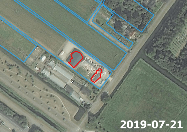
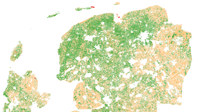
Mutation Signalling on agriculture parcels in the Netherlands 
Agriculture, crop acreage, Monitor crops, crop types extent, Land use, Assess land value, ownership, type, use, Measure land use statistics, Agricultural commodities, Agriculture and rural development policy, Farming, Real-estate management, Local and regional planners, City authorities, Planners, Regional governments, Town authorities, Agriculture and rural policy makers
NEO signals changes to agriculture parcels. Monitoring, based on satellite imagery in combination with artificial intelligence, aims to detect changes in the boundaries of the parcels. The service saves time and money because, based on the mutation signalling, parcels can be looked at more specifically to determine the new parcel boundaries. This supports the process of keeping the national LPIS (Land Parcel Identification System) registry up to date. The service that NEO provides is unique: it is the first time that mutation signalling based on earth observation is performed automatically on this scale. In this way the 500.000 parcels in the Netherlands are monitored. Open data from the national satellite data portal in the Netherlands is used.
Adicional
Adicional
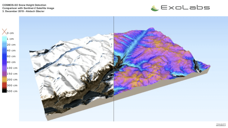
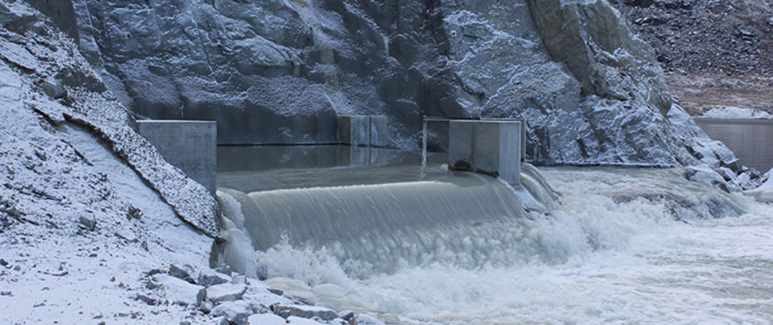
Snow Monitoring 
climate change, Assess ground water and run-off, Monitor snow cover, snow cover, Environment, Hydroelectric, Ski, Tourism
Continous Snow Monitoring System is available as global 500 m resolution snow cover, regional 20 m resolution snow cover for various areas and 20 m resolution snow depth product for Switzerland, the Rocky Mountains and Sierra Nevada. All algorithms can be further extended to any regions of interest.
Adicional
Adicional
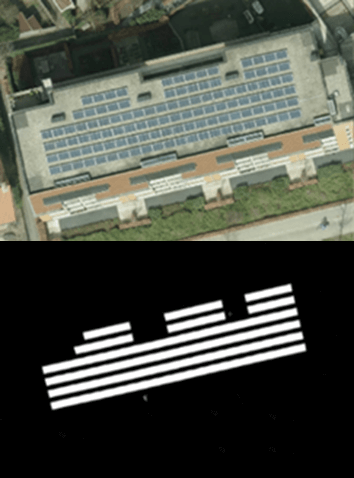
Solar panel service
Infrastructure, Map and monitor solar energy (solar farms), solar energy, solar radiation, Monitor urban areas, Urban Areas, urban development, urban settlement, urban atlas, urban areas, smart cities, individual houses inventory, Alternative Energy, Regional planners, Solar energy, Environment, Real-estate management
NEO monitors solar panels throughout the Netherlands using deep learning methods. Solar panels are detected using various resolutions of satellite and aerial imagery. The panels are digitalized by the algorithm and related to 3D-roofs based on the AHN (Dutch national height model) to calculate zenith and azimuth angles. This data, combined with data such as solar power, allows NEO to estimate the power output for each object. Solar panels are also provided with parcel and address information and statistical reports, so customers can easily apply the data and relate it to internal registrations.
Adicional
Adicional