Company

RSS-Hydro

Using the best available scientific data and Methods to help our clients and society mitigate present and future hydro-meteorological risks under a changing Climate.

About

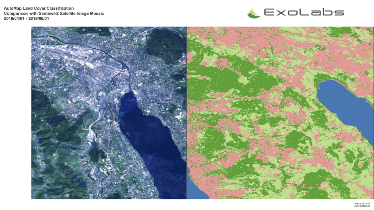
We are an R&D Company operating transversely in the field of Environmental Remote Sensing. We are building on Scientific Innovation and the newest Technologies in Remote Sensing and Computer Models to provide the best possible Solutions to mitigate Water-related Risks. We offer: (i) Science-based Products & Services in the areas of Environmental Remote Sensing and Model Predictions to help Clients and the Society mitigate present and future Hydro-Meteorological Risks under a changing Climate; (ii) Drone-based Services, such as Aerial Survey, 3D Mapping, High-precision Terrain, Precision Viti- and Agri-culture, Infrastructure Mapping, Construction Site Monitoring, Disaster Relief, River and Flood Risk Mapping; (iii) Leading cutting-edge Research & Development in Scientific Fields of Water-related Risks to find sustainable Solutions to address Society’s needs; (iv) Strong partnership with National and International Organizations (also in the humanitarian sector) to address the Challenges of our times. We constantly strive to achieve inspiring and exacting Solutions that make a genuine difference to our Public & Private Customers, as well as the Society as a whole.

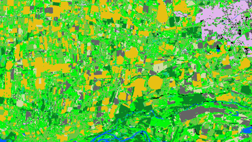
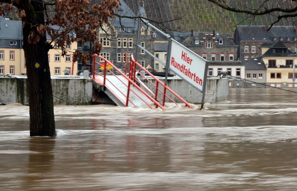
Agriculture; Atmosphere; Climate; Coastal; Fires; Floods

Certifcation
  • RSS-Hydro is a government accredited private research institute (AgrRED/17-021)
Registration Number
B216682
Address
RSS-Hydro Sarl-S L-3593 Dudelange
Telephone
+352 206005 6301
Fax
Contact Name
Guy Schumann, PhD
Contact Position
CEO & Founder
Contact Telephone
+352 206005 6301
Contact Email
info@rss-hydro.lu
Value chain
HQ location
Innovation Hub, 100 route de Volmerange, L-3593 Dudelange, Luxembourg

Compare products

0 products added

Compare

Services comparison

services

Related Content

Land Cover Analysis
Floods, Inland Water, Land Ecosystems, Geology, Forests, Infrastructure, Land use, Urban Areas, Fires, Earthquakes, Construction, Emergency Services, Environmental, Pollution & Climate, Farming, Utilities (water, electricity, waste) , Oil and Gas, Minerals and Mining
LCA stands for Land Cover Analysis and is used to provide an up to date, digital overview of what covers the surface of our earth split out into 10 key land cover classes. The LCA is often the first step in many environmental monitoring or site selection processes.
Added
Added
Land and Land Cover Analysis
Agriculture, Infrastructure, Land Ecosystems, Land use, Farming, Insurance & Finance, Local and regional planners
With AutoMap, the handling of satellite images has never been easier! We simplify the production of maps based on earth observation data and handle the application of machine learning algorithms for land surface classifications by providing a solid data processing pipeline in a fully managed cloud infrastructure. Bring your own samples or use our default solution, while we take care of the thousands of images that fit your request, all the clouds in your area of interest and every aspect of process optimization and secure data storage. Don't worry about machine learning concepts, intelligent training data collection, hyperparameter optimization or informative feature spaces - That's our job as well! Seeing the world from above is now as demanding as ordering a pizza!
Added
Added
Renovatio
Land use, Topography, Urban Areas, Land Ecosystems, Environmental, Pollution & Climate, Local and regional planners
Renovatio is a data driven decision support system for real estate sector. It helps users to find information about the building, and neighbourhood to reduce time to research information, and better estimate risk in projects.
Added
Added
EO based phytoplankton biomass service
Inland Water, Assess and monitor water bodies   , Local and regional planners, Regional governments, City authorities, Environment, Utilities (water, electricity, waste) , Water plants, Coastal management agencies
Using knowledge about how certain substances, such as one of the main pigments of the phytoplankton (Chlorophyll a - Chl a) alter the colour of the water, these parameters can be derived from optial Earth Observation (EO) satellite sensors. Water Insight provides monitoring services of Chl a based on EO data which is validated with in situmeasurements. Also the maps of WFD phytoplankton biomass status classes are created, by application of the WFD tresholds on Chl a as a proxy for phytoplankton biomass. The maps are made available in a portal, which allows to follow the lakes in time, zoom and download maps and time series.
Added
Added